 UKGEOS Data Catalogue
Base line data
Type of resources
Topics
Keywords
Contact for the resource
Provided by
Years
Formats
Representation types
Update frequencies
-
This dataset contains the acquired distributed acoustic sensing (DAS) and hydrophone datasets from a project investigating the usage DAS at the UK Geoenergy Observatory (UKGEOS) research facility in Glasgow, funded by the UK Unconventional Hydrocarbons (UKUH) small project grant. The UKGEOS site in Glasgow has repurposed an abandoned coal mine to investigate its potential as a heat source and heat sink, and its borehole infrastructure includes pre-installed fibre-optic cables. DAS is a novel seismic monitoring technique that utilizes fibre-optic cables to measure small acoustic and seismic vibrations. Comparable to a very densely spaced hydrophone or geophone array, DAS provides unparalleled data resolution and insights into the subsurface. This dataset provides both active source and passive measurements of DAS at the UKGEOS Site 2 prior to the heat pump installation, providing geophysical baseline measurements of the mine. Alongside the acquired DAS data, data from a hydrophone array co-located to the fibre-optic cable was collected during the active source survey to provide a means of comparison to the DAS. NERC and ESRC jointly funded Unconventional Hydrocarbons in the UK Energy System Programme grant - Baseline seismic monitoring survey for UKGEOS Glasgow geothermal production using Distributed Acoustic Sensing (DAS)
-
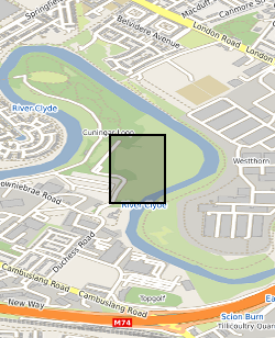
This summary borehole information release is for ‘as-built’ mine water and environmental baseline monitoring boreholes of the UK Geoenergy Observatories (UKGEOS) Glasgow facility at Cuningar Loop. The information pack from BGS contains a brief report with summary tables of locations, drilled depths, screened intervals and illustrative interpretations, and is accompanied with a spreadsheet and shapefile of the borehole locations and drilled depths. The purpose is to give potential users of the Glasgow Observatory an outline of the as-built infrastructure including condition of the target mine workings, as a summary of the more detailed information packs for each borehole. This dataset was updated in June 2020. Further details can be found in the accompanying report http://nora.nerc.ac.uk/id/eprint/526889
-

The UK Geoenergy Observatories (UKGEOS) Glasgow baseline surface water chemistry dataset1 released from the BGS comprises an excel file with two spreadsheets. The first spreadsheet contains information on the chemical composition of 98 surface water samples (84 samples and 14 field duplicates) collected monthly for 14 months between February 2019 and March 2020 from six sampling locations. These comprised three on the River Clyde at the UKGEOS Glasgow Cuningar Loop borehole cluster and three from control sites (two on the River Clyde and one on the Tollcross Burn). Field measurements of pH, redox potential, specific electrical conductance, temperature, dissolved oxygen and alkalinity and laboratory chemical data for concentrations of 71 inorganic and 10 organic substances in the surface water samples are presented. The dataset contains locational and descriptive information about the samples also. The analyte name, element chemical symbols, analytical method, units of measurement and long-term limits of detection are recorded in header rows at the top of the spreadsheet. The limits of detection/quantification for each monthly batch of samples are documented in rows at the head of each batch. The dataset includes abbreviations documenting quality control issues such as missing values. A guide to abbreviations used in the dataset is provided in the second excel spreadsheet released with the data. Further details about the dataset can be found in the accompanying report http://nora.nerc.ac.uk/id/eprint/529818.
-

The UK Geoenergy Observatories (UKGEOS) Glasgow facility, baseline soil geochemistry dataset released from the BGS comprises an excel file with two spreadsheets. The first spreadsheet contains information on the chemical composition of 90 topsoil (0 - 20 cm) samples collected from seven initially proposed borehole sites for the UKGEOS Glasgow facility, and from two control sites, in February-March 2018 (03-18). Ten samples were collected from each site prior to installation of the UKGEOS Glasgow facility, and underwent laboratory analysis. Chemical data for pH and the total concentrations of 54 inorganic and 75 organic substances in the soil samples are presented. In addition, the dataset contains locational and descriptive information about the samples noted during sampling. The analyte name, element chemical symbols, analytical method, units of measurement and limits of quantification are recorded in header rows at the top of the spreadsheet. The dataset includes qualifiers, highlighting any quality control issues reported with the data. The data qualifiers are explained in the second spreadsheet released with the data. Further details about the dataset can be found in the accompanying report http://nora.nerc.ac.uk/id/eprint/527798/.